Drone-based infrared imaging has become a game-changer in various industries, offering unique perspectives and valuable data that were previously difficult or impossible to obtain. This technology combines the flexibility of unmanned aerial vehicles (UAVs) with the power of thermal imaging, creating a versatile tool for a wide range of applications. In this comprehensive guide, we’ll explore the world of drone-based infrared imaging, discussing its applications, techniques, and the technology behind it.
Understanding Drone-Based Infrared Imaging
Infrared drones work by capturing thermal radiation emitted by objects and surfaces. Unlike traditional cameras that capture visible light, infrared cameras detect heat signatures, allowing them to “see” temperature differences. When mounted on a drone, these cameras can cover large areas quickly and access hard-to-reach locations, providing valuable thermal data from a bird’s-eye view.
Key components of a drone-based infrared imaging system include:
- Thermal camera
- Drone platform
- Gimbal for camera stabilization
- Data transmission system
- Ground control station
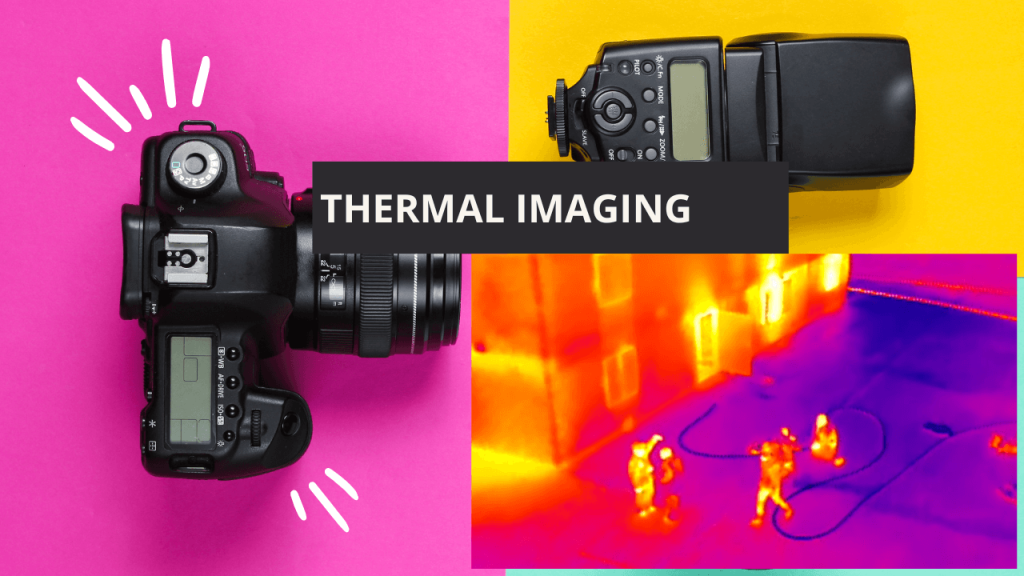
The thermal camera detects infrared radiation and converts it into a visual representation, typically using a color palette to indicate temperature variations. This data is then transmitted to the ground control station, where it can be analyzed in real-time or stored for later processing.
Applications of Drone Thermal Imagery
Drone-based infrared imaging has found applications across numerous industries, revolutionizing how we gather and analyze thermal data. Some key areas where this technology is making a significant impact include:
1. Building Inspection and Energy Audits
Infrared drones can quickly identify heat loss, insulation issues, and moisture problems in buildings. This makes them invaluable for:
- Detecting air leaks and thermal bridging
- Identifying poorly insulated areas
- Locating water damage and potential mold growth
- Assessing solar panel efficiency
2. Agriculture and Precision Farming
Drones have been powerful in Agriculture. Farmers and agronomists use thermal imagery to:
- Monitor crop health and stress levels
- Detect irrigation issues and water stress
- Identify pest infestations early
- Optimize fertilizer application
3. Search and Rescue Operations
Thermal drones assist emergency services by:
- Locating missing persons in challenging terrains
- Identifying heat signatures in low-visibility conditions
- Assessing wildfire spread and locating hotspots
4. Wildlife Conservation and Management
Conservationists employ infrared drones for:
- Conducting wildlife population surveys
- Detecting poaching activities
- Monitoring animal behavior and migration patterns
5. Industrial Inspection and Maintenance
In industrial settings, thermal drones are used for:
- Inspecting power lines and electrical substations
- Detecting overheating equipment in factories
- Assessing the integrity of solar farms
- Identifying gas leaks in pipelines
6. Environmental Monitoring
Scientists and researchers utilize drone thermal imagery for:
- Studying urban heat islands
- Monitoring volcanic activity
- Assessing the health of coral reefs
- Tracking changes in permafrost
Choosing the Right Drone for Infrared Imaging

Selecting the appropriate drone for infrared imaging depends on several factors:
- Payload capacity: Ensure the drone can carry the weight of the thermal camera and any additional equipment.
- Flight time: Consider the battery life and range required for your specific application.
- Camera resolution: Higher resolution thermal cameras provide more detailed imagery but may be heavier and more expensive.
- Gimbal stability: A high-quality gimbal is essential for capturing clear, stable thermal images.
- Environmental conditions: Choose a drone that can operate in the expected weather conditions and temperatures.
- Data transmission range: Ensure the drone can transmit thermal data over the required distance.
- Software compatibility: Check if the drone and thermal camera are compatible with your preferred analysis software.
- Regulatory compliance: Verify that the drone meets local regulations for commercial use and any specific requirements for your industry.
When choosing a drone based on application, consider the following:
- For building inspections, a smaller, more maneuverable drone may be preferable.
- Agricultural applications often require longer flight times and greater coverage areas.
- Search and rescue operations may need drones with advanced obstacle avoidance and night-flying capabilities.
- Industrial inspections might require drones with high payload capacities for specialized equipment.
Techniques for Effective Infrared Imaging with Drones
To maximize the effectiveness of drone-based infrared imaging, consider these techniques:
- Plan your flight path: Carefully map out your flight route to ensure complete coverage of the area of interest.
- Optimize flight altitude: Flying at the right height balances image resolution with area coverage.
- Consider environmental factors: Account for weather conditions, time of day, and surface temperatures that may affect thermal readings.
- Use appropriate color palettes: Choose color schemes that best highlight the temperature differences you’re looking for.
- Calibrate your equipment: Regularly calibrate your thermal camera to ensure accurate temperature readings.
- Combine with visual imagery: Overlay thermal images with standard visual images for better context and analysis.
- Utilize automated flight modes: Take advantage of pre-programmed flight patterns for consistent and repeatable results.
- Process and analyze data: Use specialized software to interpret thermal data and generate actionable insights.
Challenges and Limitations
While drone-based infrared imaging offers numerous benefits, it’s important to be aware of its limitations:
- Weather sensitivity: Rain, snow, and high winds can affect both drone operation and thermal readings.
- Limited penetration: Thermal cameras cannot see through solid objects or dense vegetation.
- Reflection and emissivity issues: Shiny surfaces can reflect infrared radiation, leading to inaccurate readings.
- Battery life constraints: The added weight of thermal cameras can reduce drone flight times.
- Legal and privacy concerns: Operating drones with thermal cameras may be subject to specific regulations and privacy laws.
- Data interpretation challenges: Thermal imagery can be complex to interpret, requiring specialized training and experience.
Future Trends in Drone-Based Infrared Imaging
The field of drone-based infrared imaging is rapidly evolving. Some emerging trends to watch include:
- AI-powered analysis: Machine learning algorithms are being developed to automatically detect anomalies in thermal imagery.
- Improved sensor technology: Higher resolution and more sensitive thermal cameras are continually being developed.
- Integration with other sensors: Combining thermal imaging with LiDAR, multispectral cameras, and other sensors for more comprehensive data collection.
- Swarm technology: Using multiple drones in coordinated flights for faster and more efficient thermal mapping of large areas.
- Edge computing: On-board processing capabilities allowing for real-time analysis and decision-making.
- Miniaturization: Smaller, lighter thermal cameras enabling their use on a wider range of drone platforms.
Conclusion
Drone-based infrared imaging has opened up new possibilities across various industries, from agriculture to search and rescue operations. By understanding the technology, applications, and techniques involved, professionals can leverage this powerful tool to gain valuable insights and improve their operations.
As the technology continues to advance, we can expect even more innovative applications and improved capabilities in the field of drone-based infrared imaging. Whether you’re a building inspector, farmer, conservationist, or industrial professional, thermal drones offer a unique perspective that can enhance your work and decision-making processes.
To stay at the forefront of this technology, consider exploring training opportunities, keeping up with the latest developments, and experimenting with different applications relevant to your field. The world of drone-based infrared imaging is full of potential, waiting to be explored and utilized in new and exciting ways.
