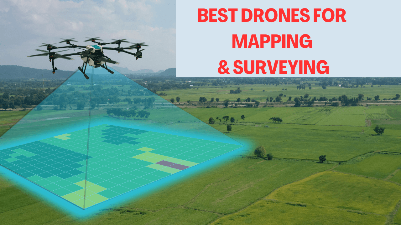
Surveying and mapping have come a long way from traditional methods that were time-consuming, costly, and often limited in scope. Enter the era of drones – these flying marvels are revolutionizing the field, offering unprecedented efficiency and accuracy. 🚁📸But with so many options flooding the market, how do you choose the right drone for your surveying and mapping needs? Whether you’re a professional surveyor, an urban planner, or an environmental conservationist, the perfect drone can make all the difference. From budget-friendly options to high-end professional-grade models, the world of surveying drones is vast and exciting.
In this comprehensive guide, we’ll explore the best drones for surveying and mapping in 2024. We’ll dive into the essential features that make a great surveying drone, from camera quality and flight time to data processing capabilities and regulatory compliance. Whether you’re looking for a drone with a mechanical shutter for crystal-clear imagery or one with extended flight times for covering large areas, we’ve got you covered. So, buckle up as we take flight through the world of surveying drones, helping you make an informed decision that will elevate your mapping game to new heights! 🗺️✨
Understanding Best Drones For Surveying and Mapping
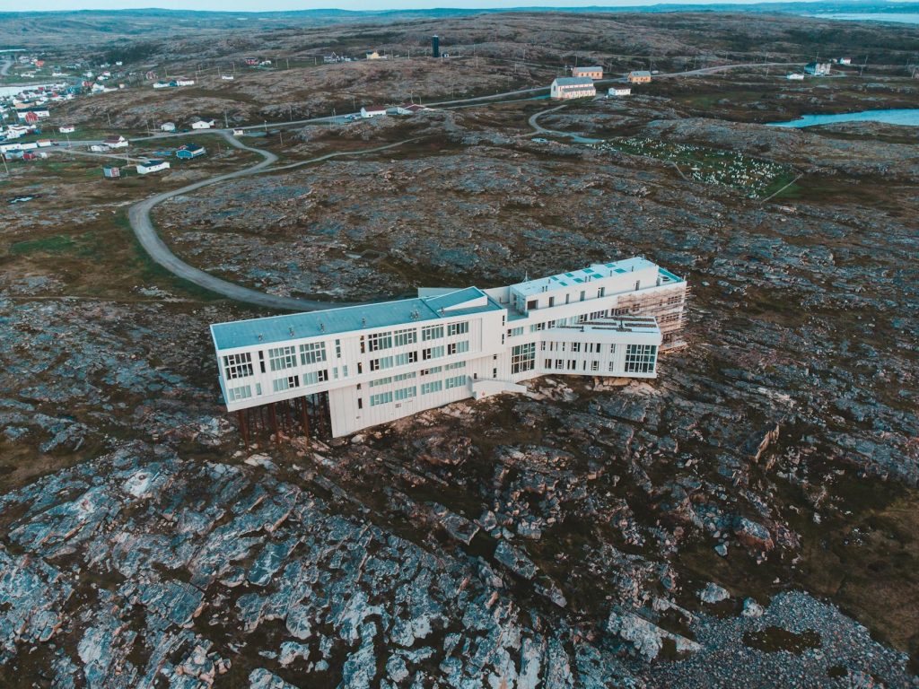
Key features for effective surveying
Surveying and mapping drones are equipped with essential features that make them highly effective for data collection:
- High-resolution cameras and sensors (RGB, multispectral, LiDAR)
- GPS/GNSS receivers for precise geo-referencing
- Real-Time Kinematic (RTK) or Post-Processing Kinematic (PPK) capabilities
- Ability to fly at low altitudes for detailed data capture
- Long battery life for extended flight times
These features enable drones to collect accurate, high-precision data quickly and efficiently, making them ideal for various surveying applications.
Benefits of using drones for mapping
Drones offer numerous advantages over traditional surveying methods:
- Cost-effectiveness: Reduced operational expenses
- Time-saving: Rapid coverage of large areas
- Enhanced safety: Minimized personnel exposure to hazardous locations
- High precision and accuracy: Detailed data collection
- Versatility: Access to remote and challenging terrains
| Benefit | Description |
|---|---|
| Efficiency | Cover large areas quickly with fewer resources |
| Accuracy | Achieve precision levels up to 1 cm under optimal conditions |
| Safety | Reduce risks by surveying hazardous or hard-to-reach areas |
| Data quality | Capture high-resolution imagery and create detailed 3D models |
| Flexibility | Adapt to various surveying applications across industries |
Regulatory considerations
When using drones for surveying and mapping, it’s crucial to comply with aviation regulations:
- Obtain necessary permits and licenses for commercial drone operations
- Adhere to flight restrictions and no-fly zones
- Ensure proper training and certification for drone pilots
- Implement data privacy measures to protect sensitive information
- Stay updated on local and national drone regulations, which may vary by location
By understanding these key aspects of surveying and mapping drones, professionals can make informed decisions about incorporating this technology into their projects. With this in mind, next, we’ll explore the “Top Professional-Grade Surveying Drones” to help you choose the right equipment for your surveying needs.
Top Professional-Grade Surveying Drones
Now that we have covered the basics of surveying and mapping drones, let’s explore some of the top professional-grade options available in the market. These drones offer advanced features and capabilities that cater to the specific needs of surveyors and mapping professionals.
A. DJI Phantom 4 RTK
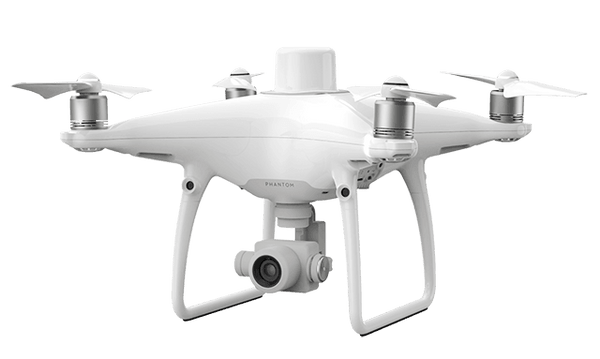
The DJI Phantom 4 RTK remains a strong contender in the professional mapping arena. Key features include:
- 1-inch CMOS sensor
- RTK technology for centimeter-level accuracy
- Upgraded controller
- Flight time of up to 30 minutes
While it lacks compatibility with Post-Processing Kinematic (PPK) workflows, its RTK capabilities make it an excellent choice for precise mapping tasks.
B. senseFly eBee X
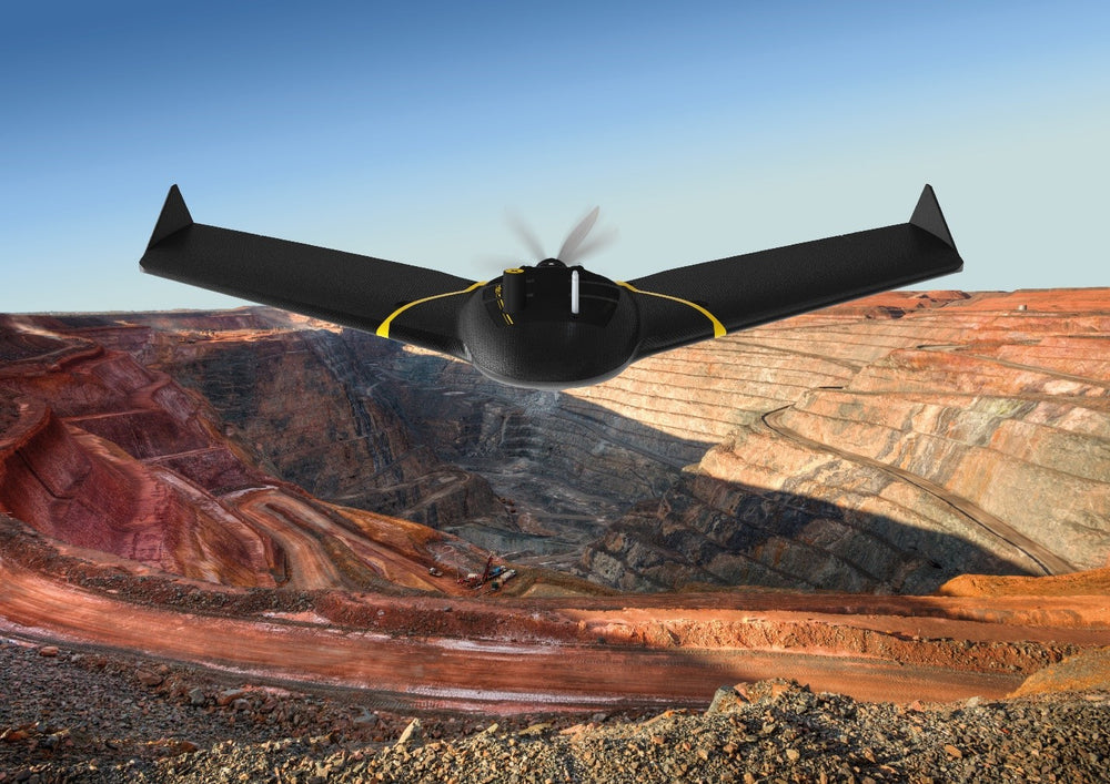
The senseFly eBee X is a fixed-wing drone that offers exceptional performance for large-scale surveys:
- Flight times up to 90 minutes
- Supports both RTK and PPK workflows
- Suitable for extensive survey areas
- Cost can reach $15,000 with accessories
| Feature | Specification |
|---|---|
| Design | Fixed-wing |
| Flight Time | Up to 90 minutes |
| Workflow Support | RTK and PPK |
| Best For | Large survey areas |
C. Yuneec H520E RTK
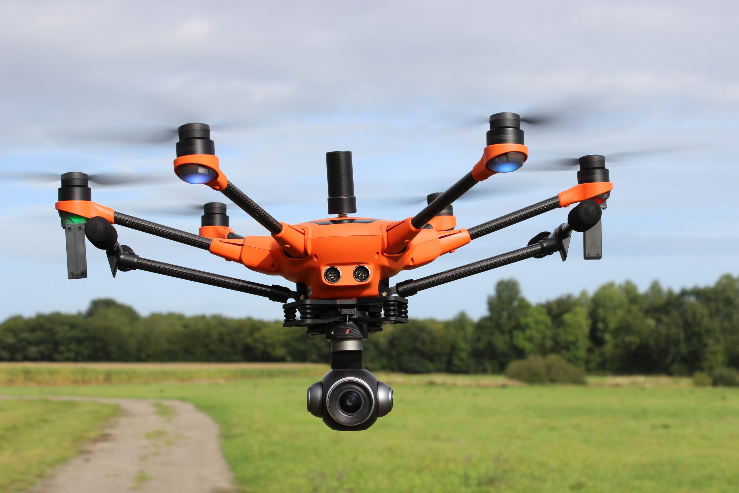
The Yuneec H520E RTK offers flexibility and efficiency for surveying tasks:
- Non-fixed payload compatibility
- Supports PPK processes
- Efficient data collection in areas with unreliable communication
- Hexacopter design for stability
D. DJI Matrice 300 RTK
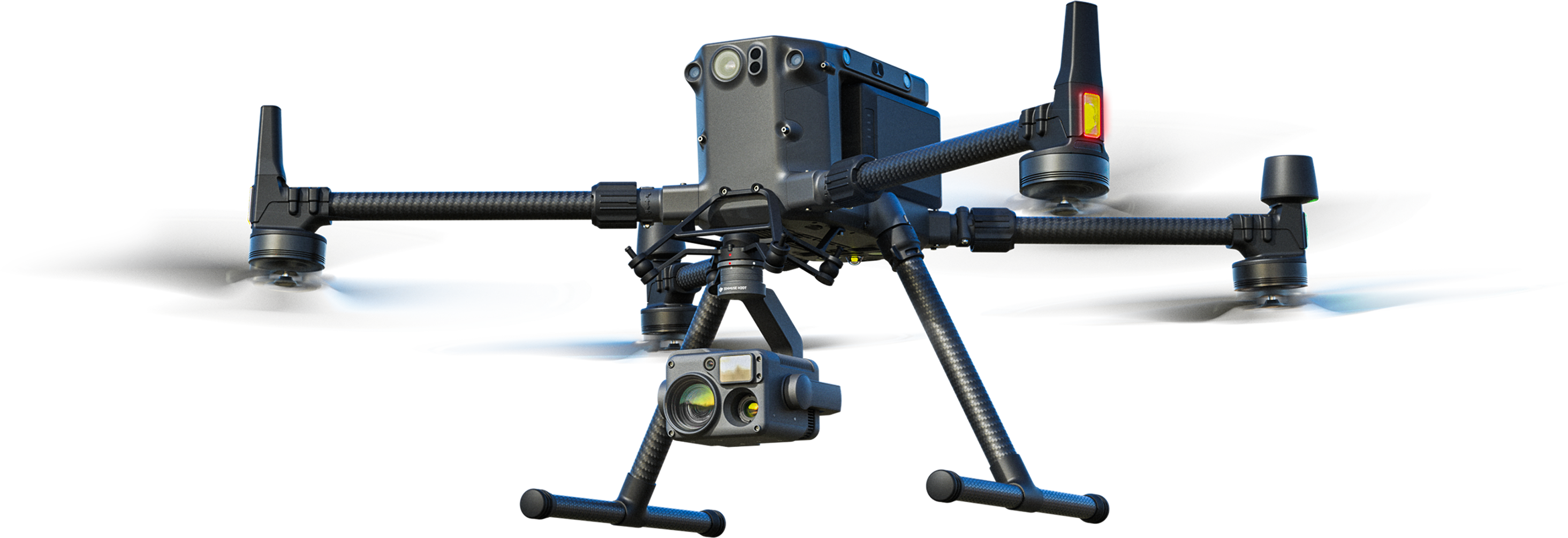
The DJI Matrice 300 RTK, when equipped with a Zenmuse P1 camera, stands out as the top choice for professionals:
- Full-frame camera with global mechanical shutter
- Capability to produce highly accurate models without ground control points
- Extended flight time of up to 55 minutes
- IP55 weather resistance rating
- Four-sensor camera system (zoom, wide, thermal, and laser rangefinder)
While it comes at a substantial cost and size, its advanced features make it ideal for high-precision mapping and surveying tasks.
With these professional-grade options in mind, next, we’ll explore some best budget-friendly alternatives for those looking to enter the field of drone surveying and mapping without breaking the bank.
Now that we’ve explored the top professional-grade surveying drones, let’s shift our focus to more budget-friendly options that still offer impressive capabilities for surveying and mapping tasks.
Best Budget-Friendly Options
For those looking to enter the world of drone surveying without breaking the bank, there are several excellent options available that balance cost with performance.
DJI Mavic 2 Pro
The DJI Mavic 2 Pro stands out as an excellent entry-level drone for surveying and mapping:

- 20MP camera with 1-inch CMOS sensor
- Compact and portable design
- Impressive flight time of up to 31 minutes
- Intelligent flight modes for easy operation
While it may not have the advanced RTK capabilities of its more expensive counterparts, the Mavic 2 Pro offers a great starting point for those new to drone surveying.
Autel EVO II Pro

The Autel EVO II Pro RTK V3 offers a compelling mix of features at a more accessible price point:
| Feature | Specification |
|---|---|
| Camera Resolution | 20MP |
| Flight Time | Up to 40 minutes |
| RTK Compatibility | Yes |
| Weight | Lightweight design |
Its lightweight design and impressive imaging capabilities make it ideal for photogrammetry applications, offering a balance between professional-grade features and affordability.
Parrot Anafi USA
While not explicitly mentioned in the reference content, the Parrot Anafi USA is often considered a budget-friendly option for surveying. However, based on the information provided, we’ll focus on an alternative that was discussed:
TOPODRONE DJI Mavic Mini PPK
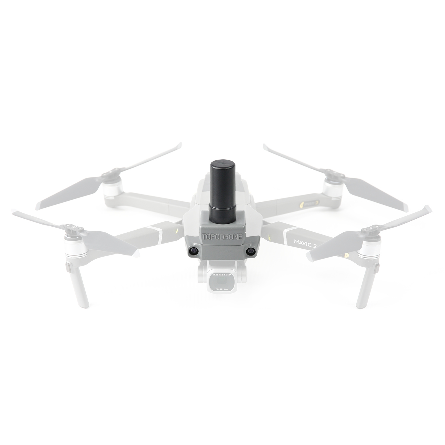
This ultra-lightweight drone offers surprising capabilities for its size and price:
- Weighs under 250 grams
- 16-minute flight time
- Covers up to 10 hectares in a single flight
- Compatible with TOPOSETTER 2 PRO software for GNSS postprocessing
- Achieves 3-5 cm accuracy with minimal ground control points
The TOPODRONE DJI Mavic Mini PPK proves that even entry-level drones can produce professional-grade results when paired with the right software and techniques.
These budget-friendly options demonstrate that high-quality surveying and mapping can be achieved without investing in the most expensive equipment. By leveraging advanced software and careful flight planning, even these more affordable drones can produce accurate and valuable data for various surveying applications.
With these cost-effective drone options in mind, next, we’ll explore the essential accessories that can enhance your surveying capabilities, regardless of which drone you choose.
Now that we’ve explored budget-friendly drone options for surveying and mapping, let’s delve into the essential accessories that can enhance your drone’s capabilities and improve the quality of your surveying work.
Essential Drone Accessories for Surveying
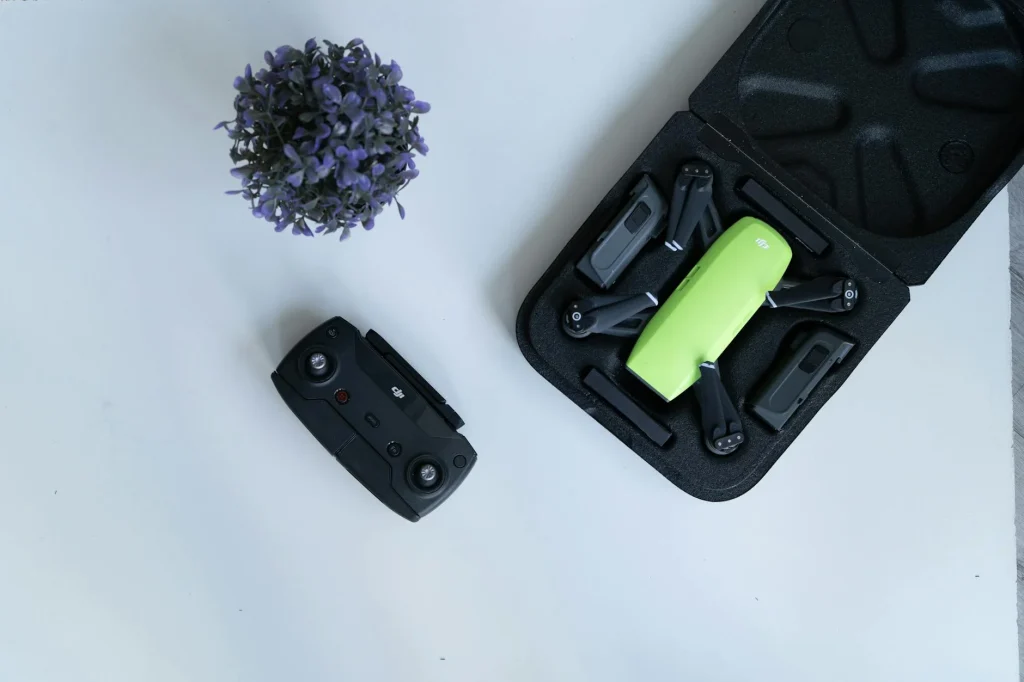
A. High-resolution cameras
High-resolution cameras are crucial for capturing detailed imagery during surveying missions. For instance, Epoc Unmanned’s quadrotor and octorotor survey drones come equipped with 42MP full-frame Sony cameras, providing accurate 3x Ground Sampling Distance (GSD) results without the need for ground control.
B. RTK modules
Real-Time Kinematic (RTK) modules significantly improve positioning accuracy. The DJI D-RTK 2 High Precision GNSS Mobile Station offers real-time differential corrections for enhanced positioning precision, making it an invaluable accessory for surveying drones.
C. LiDAR sensors
While not explicitly mentioned in the reference content, LiDAR sensors are often crucial for detailed 3D mapping and are commonly used in surveying applications.
D. Multispectral sensors
Multispectral sensors, although not directly referenced, are frequently used in advanced surveying and mapping applications, particularly for environmental and agricultural assessments.
E. Software solutions
Software solutions play a vital role in processing and analyzing survey data. Companies like Pix4D offer specialized software for drone-based surveying and mapping applications.
| Accessory | Function | Example |
|---|---|---|
| High-resolution cameras | Detailed imagery capture | 42MP Sony camera (Epoc Unmanned drones) |
| RTK modules | Improved positioning accuracy | DJI D-RTK 2 High Precision GNSS Mobile Station |
| LiDAR sensors | 3D mapping and terrain analysis | Not specified in reference |
| Multispectral sensors | Specialized data collection | Not specified in reference |
| Software solutions | Data processing and analysis | Pix4D software |
Other essential accessories for surveying drones include:
- Upgraded propellers: DJI Matrice 350 RTK 2110s and 2112 propellers enhance performance, reduce noise, and extend flight times.
- Advanced controllers: The DJI RC Plus Remote Controller features a large, bright screen and IP54 protection, ideal for outdoor use.
- Base stations: Epoc’s multi-band static logging base station simplifies the survey process with one-button operation.
These accessories work together to improve the overall efficiency, accuracy, and reliability of surveying drones. For example, the combination of high-resolution cameras with RTK modules ensures precise geolocation of captured imagery, while advanced propellers and controllers contribute to longer flight times and better handling in challenging conditions.
With these essential accessories in mind, next, we’ll explore how to choose the right drone for your specific surveying needs, considering factors such as the type of project, environmental conditions, and required accuracy levels.
Now that we have covered the essential drone accessories for surveying, let’s delve into the crucial process of choosing the right drone for your specific needs. With the wide array of options available, it’s important to consider several key factors to ensure you select the most suitable drone for your surveying projects.
Choosing the Right Drone for Your Needs
Project requirements assessment
When selecting a drone for surveying, it’s essential to assess your project requirements carefully. Different industries have distinct needs, and the purpose of your survey will greatly influence your choice. For instance:
- Agricultural surveys may require drones with thermal imaging capabilities
- Construction surveys might need high-resolution cameras or LiDAR sensors
Consider the following factors when assessing your project requirements:
- Survey purpose
- Area size and complexity
- Required data accuracy
- Specific sensor needs (e.g., RGB cameras, LiDAR, multispectral sensors)
Budget considerations
Budget plays a significant role in drone selection, as prices can vary widely. When evaluating your budget, consider:
| Cost Factor | Description |
|---|---|
| Initial purchase | Drone prices range from $8,000 to $30,000 |
| Ongoing costs | Maintenance and software subscriptions |
| Durability | Higher-priced models often offer longer lifespans |
It’s important to balance your immediate budget constraints with long-term value and return on investment. While multirotor drones are generally more affordable, fixed-wing and VTOL models may offer greater efficiency for large-scale projects.
Ease of use and learning curve
The complexity of drone operation varies, and it’s crucial to consider your team’s expertise when making a selection. For beginners, user-friendly options like the DJI Mavic Air 2 can be a good starting point. However, for professional surveying, more advanced models such as the DJI Phantom 4 RTK are recommended due to their precision and optimal flight times.
Factors affecting ease of use include:
- Drone type (multirotor, fixed-wing, or VTOL)
- Flight control systems
- Software integration
- Required licensing and training
Support and warranty options
When investing in a drone for surveying, it’s crucial to consider the available support and warranty options. While this information isn’t explicitly provided in the reference content, it’s an important factor to keep in mind. Look for manufacturers that offer:
- Comprehensive warranty coverage
- Technical support services
- Training programs
- Repair and maintenance services
By carefully considering these factors – project requirements, budget, ease of use, and support options – you can make an informed decision when selecting the right drone for your surveying needs. Remember that the optimal choice will depend on your specific project requirements and operational context.
Selecting the right drone for surveying and mapping can significantly enhance efficiency, accuracy, and cost-effectiveness in various industries. From professional-grade options like the DJI Matrice 350 RTK to budget-friendly alternatives such as the eBee Geo, there’s a wide range of drones available to suit different needs and budgets. Key features to consider include mechanical shutters for improved image quality, RTK compatibility for enhanced accuracy, and extended flight times for covering larger areas.
As drone technology continues to evolve, it’s crucial to stay informed about the latest advancements and regulations in the field. Whether you’re a professional surveyor or just starting out, investing in the right drone and accessories can greatly improve your mapping capabilities. Remember to consider your specific requirements, budget, and local regulations when making your choice. With the right drone in hand, you’ll be well-equipped to tackle complex surveying and mapping projects with precision and efficiency.
